


What is left of Mariupol? Nothing.
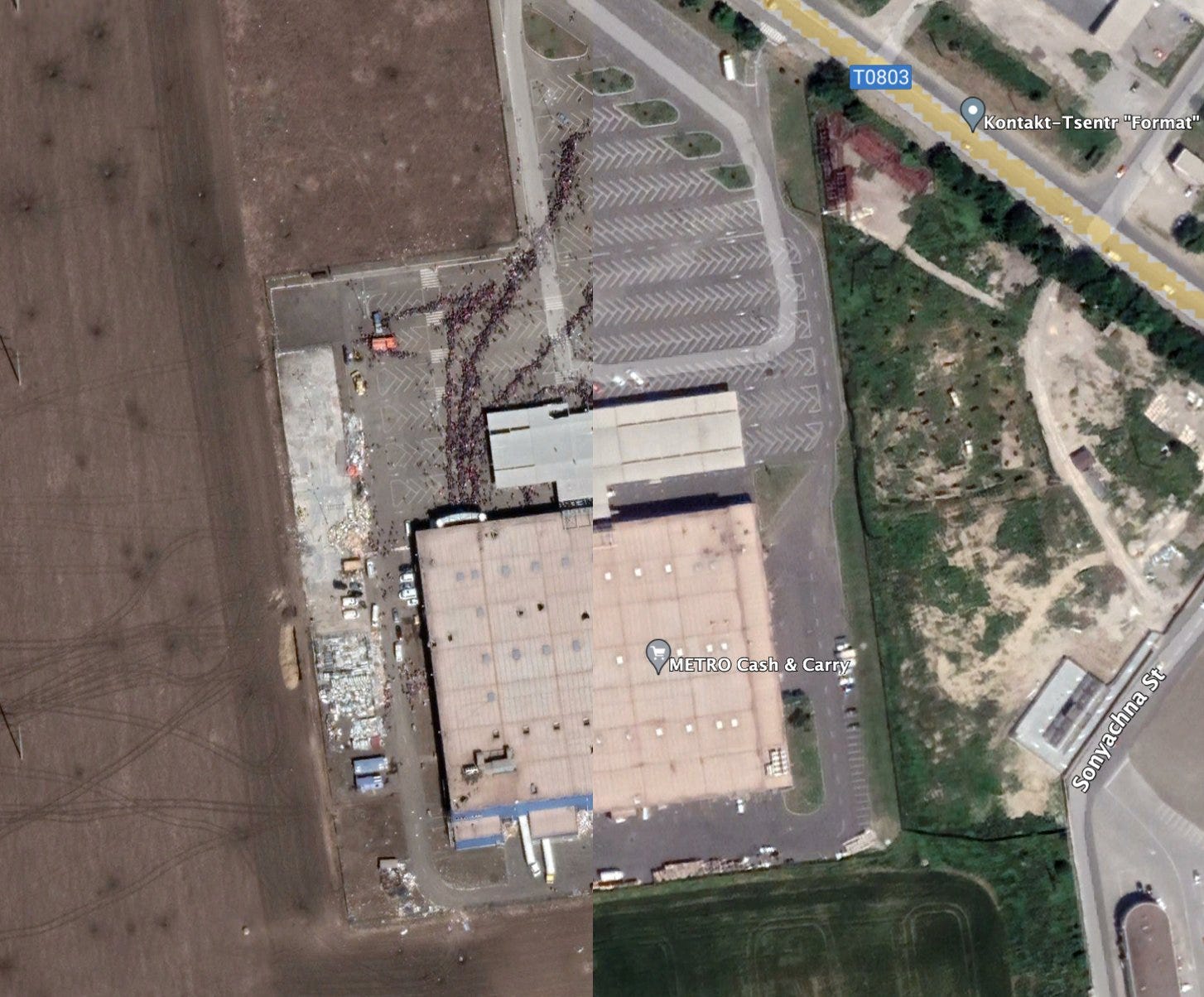
Google Earth has up-dated its satellite images for Mariupol, and today they are being uploaded onto social media. They show us the extent of destruction of the Russia’s full-scale invasion. They are beyond words. Total devastation.
I’ve collected some of the images, though not all. Judging by the history of the destruction, reports Ukrainska Pravda, the Google satellite photos were taken on different dates after the middle of March 2022. At the end of the post, I’ve included a short Associated Press reportage about life for Ukrainians under Russian occupation.


Via Sergej Sumlenny: District Court House


Life for Ukrainians under Russian occupation
How the Ukrainians still living in Mariupol under Russian occupation are surviving is a question that haunts us all. The Associated Press collected video and satellite images to document life in Mariupol under Russian occupation, and released the following video reportage in December 2022.
“The Russians are slowly rebuilding the shattered Ukrainian port city of Mariupol. But they are also erasing the former national identity of what was a symbol of Ukrainian defiance.” (AP Video/Marshall Ritzel)

Share this post